
Dam Instrumentation
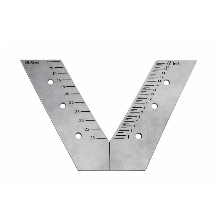
V-Notch Weirs
V-Notch Weirs, also known as triangular weirs, are precision-engineered flow measurement devices designed for open channel flow in civil engineering, hydrology, and environmental applications. These devices are essential for accurately measuring the flow of liquids, particularly in streams, rivers, and channels.
| Material: | Stainless Steel / Galvanized Iron |
|---|---|
| Angle of Notch: | 30°, 45°, 60° (Customizable) |
| Capacity: | 300 – 1500 mm |
| Accuracy: | 0.1% F.S |


Automatic V Notch Weir system
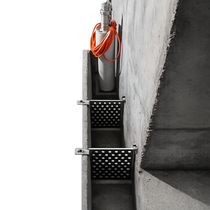
An Automatic V-Notch system is used for continuous measurement of low-flow and seepage discharge in dams, embankments, canals, and drainage systems.
The system uses a vibrating wire water level sensor to measure head over a calibrated V-notch weir and automatically computes discharge with high stability and reliability, making it ideal for critical dam safety applications.
| Sensor | VW force transducer |
|---|---|
| Range | 300 mm, 600 mm, 1500 mm |
| Resolution | 0.025% FSR |
| Accuracy | ±0.1% FSR |
| Nonlinearity | ±0.5% FSR |
| Operating temperature | -30∼70 ℃ |
Built-in temperature device Thermistor (3kΩ), can be connected to the readout unit/Datalogger
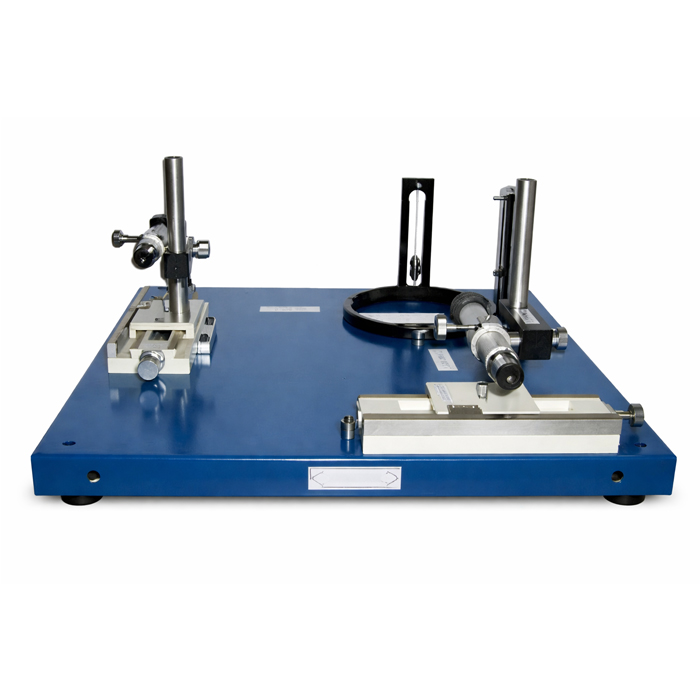
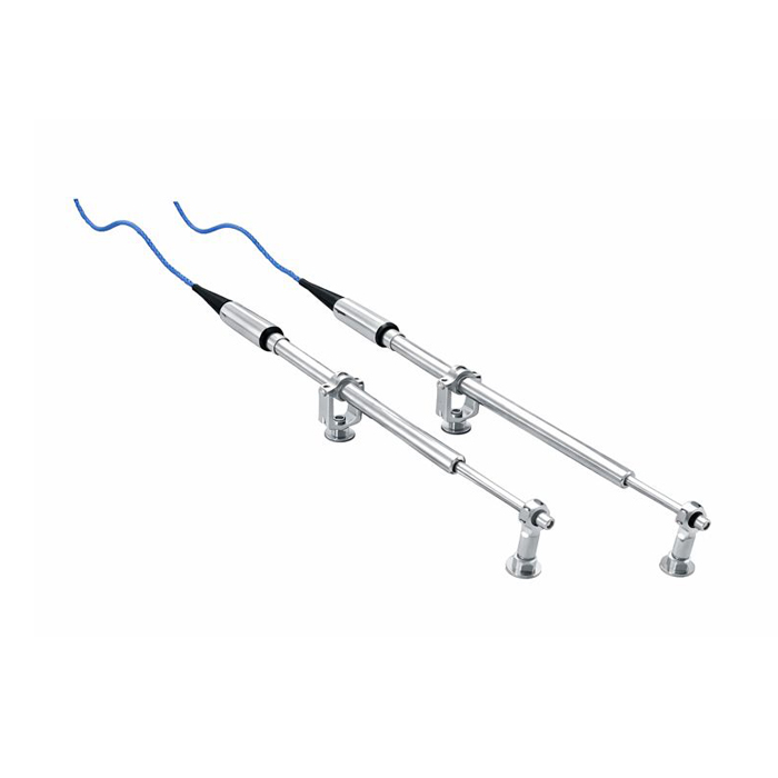
Plumbline/Pendulum System
Manual Direct and Inverted Plumbline
The Manual Plumb Line System is a reliable and time-tested instrument used to measure horizontal displacement and tilt of large civil structures such as concrete dams, gravity dams, arch dams, retaining walls, and deep foundations.
The system operates on a purely mechanical principle, using a suspended plumb wire with a heavy weight, providing high long-term stability and accuracy without the need for electrical power or electronics. It is especially suitable for permanent installations in dam galleries and shafts, where long-term deformation monitoring is critical.
The Manual Plumb Line is widely accepted by dam safety authorities and complies with standard practices recommended by ICOLD and BIS guidelines.
System Components
- High-strength stainless steel / invar plumb wire
- Heavy plumb bob (weight) for stable vertical reference
- Guide pulleys with low-friction bearings
- Reference frame / measuring table at observation level
- Manual micrometer or dial gauge arrangement for displacement measurement
- Oil or water damping arrangement (optional)
- Protective housing for long-term installation
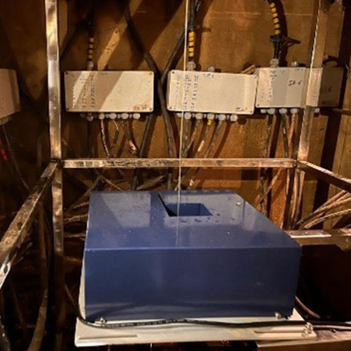
Automatic Plumbline System
The Automatic Plumbline Monitoring System is used for continuous and highly accurate measurement of X and Y axis of the pendulum wire. It is widely used in dam safety and structural health monitoring, particularly for concrete dams, to detect tilt, deflection, and long-term structural movement with high reliability.
A high-tensile plumb wire is suspended from a fixed reference point and kept under constant tension using a weight immersed in damping fluid.
A CCD (Charge-Coupled Device) sensor-based reading unit continuously tracks the position of the plumb wire with high resolution. The displacement of the wire relative to the structure is digitally processed to determine horizontal movement and tilt in orthogonal directions.
| Measurement Range | ±25mm (X,Y) |
|---|---|
| Accuracy | More than ±0.05mm |
| Water Proof | IP 67 Rated |
| Communication | RS 485, Can be connected to the display system or Datalogger |
Crack Meter / Joint Meter
Crack Meters, also known as Joint Meters, are precision instruments designed to monitor and measure the movement of cracks, joints, and fissures in structures. These instruments help in the early detection of potential structural failures, ensuring safety and facilitating timely maintenance.
| Material: | Stainless Steel / Alloy (Sensor Housing) |
|---|---|
| Measurement Range: | 50 mm to 150 mm |
| Accuracy: | ±1% of F.S |
| Gauge Length: | 50 mm, 100 mm, 150 mm, or as specified |
| Temperature Range: | −20°C to +80°C |
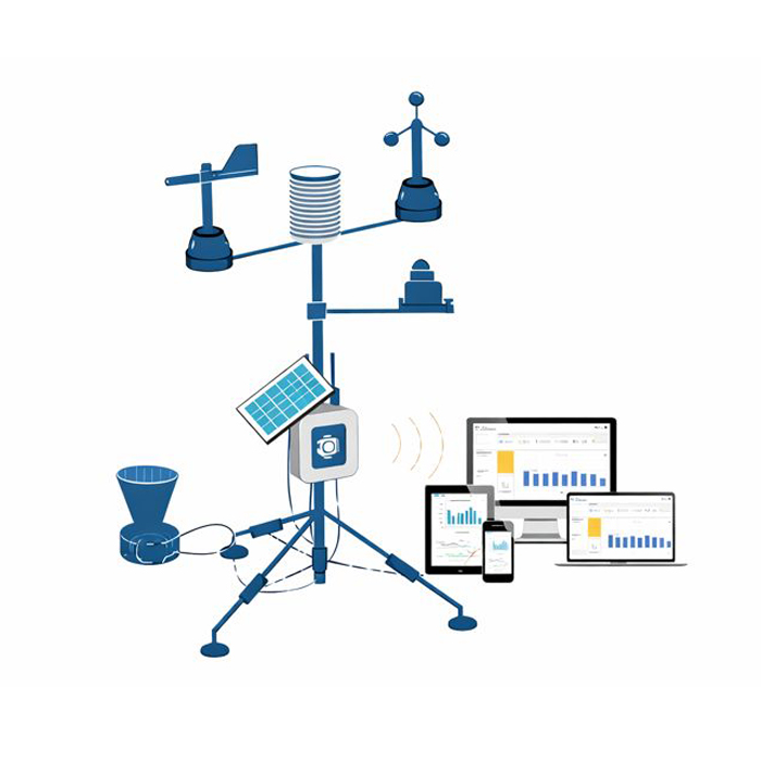
Automatic Weather Station (AWS)
The Automatic Weather Station (AWS) is an advanced monitoring system designed to measure, record, and transmit a wide range of meteorological parameters in real time. It provides continuous and reliable data for applications such as weather forecasting, climate studies, and disaster management.
Key Features
- Comprehensive Monitoring: Measures temperature, humidity, wind speed and direction, rainfall, solar radiation, barometric pressure, and more
- Real-Time Data Transmission: Supports GPRS, 4G, satellite, or Wi-Fi communication
- Data Logging & Storage: Integrated data logger with substantial storage capacity
| Temperature Range: | −10°C to +60°C |
|---|---|
| Humidity Range: | 0% to 100% RH |
| Wind Speed Measurement: | 0 to 60 m/s |
| Rainfall Measurement: | 0 to 1000 mm/day |
| Solar Radiation Sensor: | Measures up to 2000 W/m² |
| Barometric Pressure: | 600 to 1100 hPa |
| Power Supply: | Solar power with battery backup or mains power |
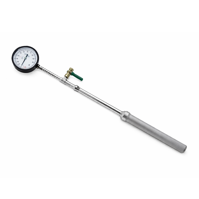
Uplift Pressure Gauge
The Uplift Pressure Gauge is a specialized instrument designed to measure the uplift pressure exerted by groundwater or other fluids on structural elements such as foundations, retaining walls, and sheet piles. The system consists of a Bourdon Gauge, T assembly, and a VW sensor as an optional item.
| Pressure Range | 0 to 10 bar or 0 to 150 psi |
|---|---|
| Accuracy | ±1% of full scale or better |
| Material | Stainless steel |
| Temperature Range | -10°C to +60°C |
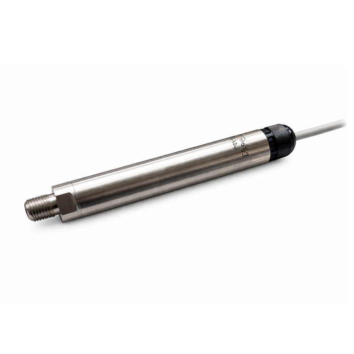
Vibrating Wire Uplift Pressure Gauge
The Vibrating Wire (VW) Type Uplift Pressure Gauge is designed for accurate, long-term measurement of uplift pressure beneath concrete dams, spillways, raft foundations, and hydraulic structures.
| Measurement Range | 3,5,7,10,20,35,50 Higher Ranges on Request |
|---|---|
| Non-linearity | 1% fs |
| Material (outer body) | Stainless steel |
| Operating Temperature | -10 to 70°C |
| Thermistor | YSI 44005 or equivalent |
| Dimension | 20mm dia x 145 mm length |
| Filter | High and low air entry Ceramic |
| Cable | 1m, 4 core shielded. |
Water Level Recorder
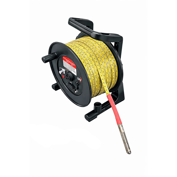
Water Level Sounder
The Water Level Sounder is a highly accurate instrument designed to measure the depth of water in wells, boreholes, and other open water bodies.
Key Features
- Audible and Visual Indicators: Equipped with a buzzer and LED light for easy detection of water levels
- Portable Design: Compact and lightweight, suitable for remote locations
- Variable Cable Lengths: Available in 30 m, 50 m, and 100 m options (or as required)
| Measurement Range: | 30, 50, 100, 150, 200, 300, 400, 500 meters (model-dependent) |
|---|---|
| Accuracy: | ±1 mm |
| Cable Material: | High-quality, non-stretchable graduated tape |
| Indicator Type: | Audible buzzer and visual LED light |
| Power Supply: | Replaceable or rechargeable batteries |
| Operating Temperature: | −10°C to +60°C |
| Probe Material: | Stainless Steel or corrosion-resistant alloy |
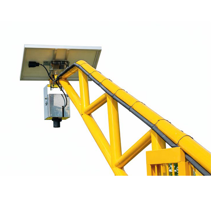
Automatic Water Level Recorder – Radar Type
The Automatic Water Level Recorder for dams uses radar technology to provide continuous and accurate monitoring of water levels in reservoirs, dams, and lakes. It measures the distance between the sensor and water surface using electromagnetic waves, ensuring precise real-time data for flood monitoring and water resource management.
Key Features
- Real-Time Data Acquisition: Continuous monitoring and recording
- Automatic Operation: Fully automated data logging, transmission, and alerts
- Remote Monitoring: Supports cellular, satellite, or Wi-Fi communication
- Integrated Alarm System: Alerts for high or low water levels
| Measurement Range: | Typically 0 to 120 meters |
|---|---|
| Accuracy: | ±1 mm |
| Radar Frequency: | 76 GHz – 81 GHz |
| Data Storage: | Internal memory |
| Power Supply: | AC, DC, battery, or solar (for remote installations) |
| Data Recording Interval: | 1 second (fastest 100 ms) |
| Wave Velocity Angle: | 3° / 8° / 20° |